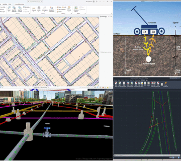
- Development of a base map for Abha City as part of the spatial data infrastructure enhancement project.
- Utilized high-resolution aerial imagery (30 cm) and drone imagery (2 cm) for detailed mapping.
- Applied 3D modeling techniques to capture and document descriptive spatial data.
- Structured and hosted the spatial database to produce accurate digital maps supporting urban planning and service management applications.
ClientAseer Municipality
ServiceMapping